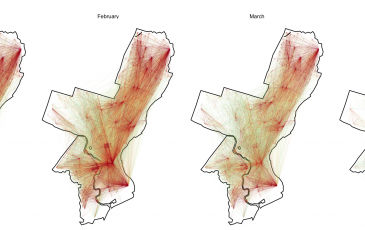
Founder, Ken Steif, recently worked with one of his students, Andrew Renninger, to analyze data from SafeGraph, a provider of…
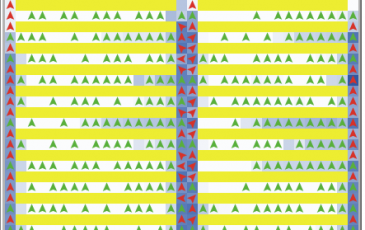
NetLogo – Simulating classroom evacuation
I started playing with NetLogo years back as a possible avenue for modeling housing markets. Ultimately, I decided that agent-based modeling, while…

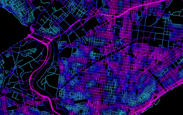
Origins & Destinations: Visualizing bike share trips
Click for higher resolution Ever since Mike Batty and team at UCL’s Centre for Advanced Spatial Analysis showcased their project using…
How can city open data help us plan safer streets?
Ken Steif & Erick Guerra of the Department of City & Regional Planning at Penn recently submitted a Knight News Challenge…

Uber’s data can help us better regulate congestion
Uber introduced competition into a market where it previously did not exist and consumers have scored a resounding victory as…