In April of 2016, the State of Pennsylvania voted to legalize medical marijuana. Currently, Philadelphia City Council members are debating how to use…
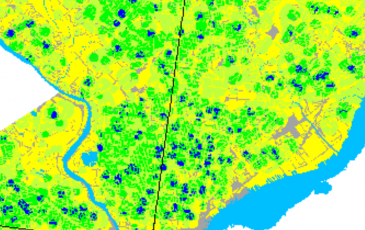
Urban heat islands & street trees in Philadelphia
Source: NASA, Earth Observatory This past August, 2016 was the hottest in 136 years according to NASA. In cities, this…

AISP Innovation
Urban Spatial is excited to partner with the Actionable Intelligence for Social Policy at the University of Pennsylvania to develop technology that lowers the…

NetLogo – Simulating classroom evacuation
I started playing with NetLogo years back as a possible avenue for modeling housing markets. Ultimately, I decided that agent-based modeling, while…

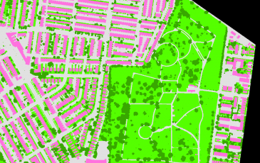
A predictive site suitability approach to land conservation
Suitability modeling is one of the most important GIS skill sets for a spatial analyst to master. Traditionally, site suitability is…

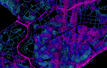
Origins & Destinations: Visualizing bike share trips
Click for higher resolution Ever since Mike Batty and team at UCL’s Centre for Advanced Spatial Analysis showcased their project using…
Predicting restaurant inspection failures
This year I ramped up the amount of machine learning I covered in my fall class at Penn. For the final…
How can city open data help us plan safer streets?
Ken Steif & Erick Guerra of the Department of City & Regional Planning at Penn recently submitted a Knight News Challenge…

Uber’s data can help us better regulate congestion
Uber introduced competition into a market where it previously did not exist and consumers have scored a resounding victory as…